Calendar
Special Event
Dedication Ceremony – Pauper Grave Marker
Dunstan Cemetery, Scarborough, Maine
May 24, 2026 | 11:00 AM
Businesses
Hotels, Motels, & Inns
Atlantic House
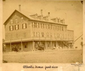
Photograph by McKenney, Portland, Me.
Courtesy of the Scarborough Historical Society.
Brochure – Atlantic House, large 17″ x 11″
Menu – Atlantic House Wine List & Luncheon Menu
Clippings – Atlantic House Clippings – Includes a 1981 article, “The Atlantic House: A grand old lady preserves the atmosphere of an English novel” and two articles regarding the hotel being demolished in 1987.
Early “snapshots” of the Atlantic c. 1908:
- View of Atlantic House in 1908.
- Atlantic House addition under construction 1908.
- Atlantic House Cook working – c. 1908.
- Atlantic House kitchen, c. 1908. – Text
- Atlantic House lawn, c. 1908
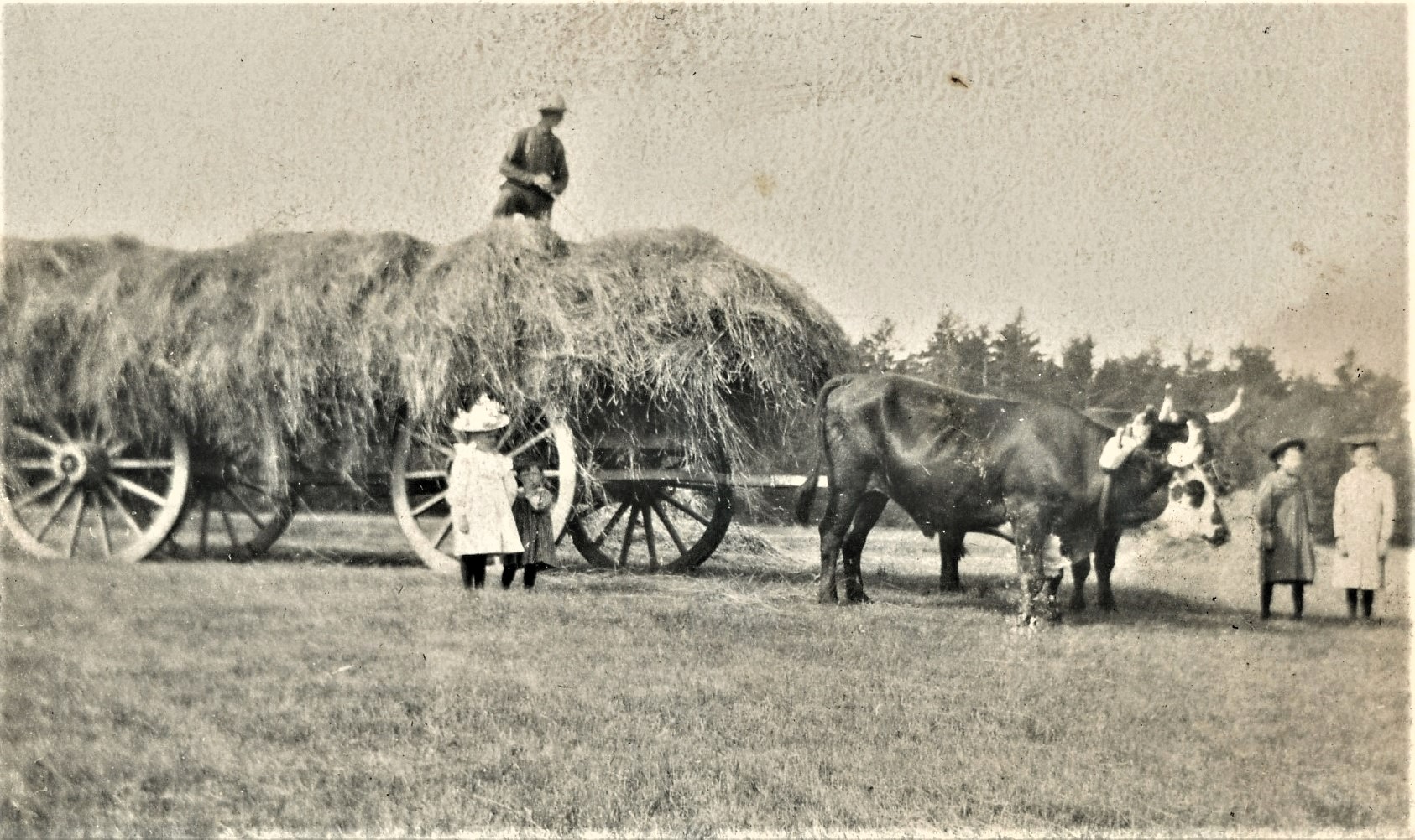
I created a Gallery for Agriculture and added a photo of the Hayfield at the Atlantic House with workers and a horse-drawn wagon from the late 1800s.

Collections
Tammy Shepherd Collection
Shepherd-Swasey Photo Album
Everett Swasey, et al, in Army Uniforms
Education
Grammar Schools
Black Point School
Black Point School – ca. 1879 – baseball team.
The original photograph has handwritten identification on the reverse.
Dunstan Grammar – Class of 1939 – Grades 1 through 7
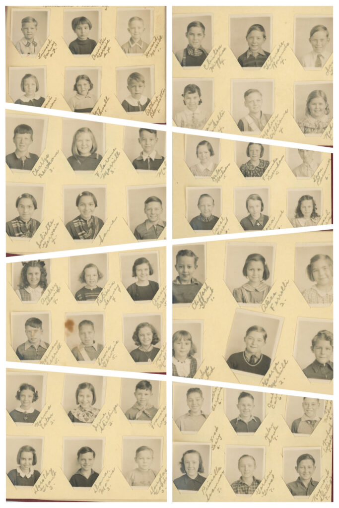
| Name | Page | Position | Grade/Part |
|---|---|---|---|
| Linwood Varney | Page 0 | 1 | pt. 1 |
| Annette Gervais | Page 0 | 2 | pt. 1 |
| Howard Merrill | Page 0 | 3 | pt. 1 |
| Naomi Munson | Page 0 | 4 | pt. 1 |
| Joy Sewell | Page 0 | 5 | pt. 1 |
| Arthur Blanchette | Page 0 | 6 | pt. 1 |
| Bryce Norrie | Absent | 1 | pt. 1 |
| Billy Burnham | Absent | 2 | pt. 1 |
| Helen Brooks | Absent | 3 | pt. 1 |
| Ethel Brooks | Absent | 4 | pt. 1 |
| Mattie Brooks | Absent | 5 | pt. 2 |
| Clifford Grant | Page 1 | 1 | pt. 1 |
| Alice Ferrelli | Page 1 | 2 | pt. 2 |
| Adelaide W. Higgins | Page 1 | 3 | pt. 2 |
| Gladys Dalton | Page 1 | 4 | pt. 2 |
| George Merrill | Page 1 | 5 | pt. 2 |
| Richard Beachley | Page 1 | 6 | pt. 2 |
| Norma Eaton | Page 2 | 1 | pt. 2 |
| June Skillings | Page 2 | 2 | pt. 3 |
| Francis Wood | Page 2 | 3 | pt. 3 |
| Dorothy McGrant | Page 2 | 4 | pt. 3 |
| George Dana MorrisMcIntire | Page 2 | 5 | pt. 2 |
| Douglas Goodrich | Page 2 | 6 | pt. 2 |
| Charles Burnham | Page 3 | 1 | pt. 3 |
| Florence Merrill | Page 3 | 2 | pt. 3 |
| Malcolm Dodge | Page 3 | 3 | pt. 3 |
| Juliette Gervais | Page 3 | 4 | pt. 4 |
| [same] | Page 3 | 5 | pt. 4 |
| Wesley Varney | Page 3 | 6 | pt. 4 |
| Clinton Higgins | Page 4 | 1 | pt. 4 |
| Gilmore Rounds | Page 4 | 2 | pt. 4 |
| James Geary | Page 4 | 3 | pt. 4 |
| Mary Ferrelli | Page 4 | 4 | pt. 4 |
| Melvin Williams | Page 4 | 5 | pt. 4 |
| Roberta Carter | Page 4 | 6 | pt. 4 |
| Audrey Davis | Page 5 | 1 | pt. 4 |
| Patricia Seavey | Page 5 | 2 | pt. 4 |
| Anne Bradford | Page 5 | 3 | pt. 5 |
| Norman Verrill | Page 5 | 4 | pt. 5 |
| Lewewis Gervais | Page 5 | 5 | pt. 5 |
| Marion Milliken | Page 5 | 6 | pt. 5 |
| Charles Kilby | Absent | 1 | pt. 5 |
| Helen Nielson | Page 6 | 1 | pt. 5 |
| Frances Burnham | Page 6 | 2 | pt. 5 |
| Leon Plummer | Page 6 | 3 | pt. 6 |
| Carol Guest | Page 6 | 4 | pt. 6 |
| Lona Plummer | Page 6 | 5 | pt. 6 |
| Mayael Morris | Page 6 | 6 | pt. 6 |
| Gerrad Gervais | Page 7 (top & bottom rows) | 1 | pt. 6 |
| Carl Carter | 7Page 7 (top & bottom rows)Page 7 (top & bottom rows) | 2 | pt. 7 |
| Lawrence Nielson | Page 7 (top & bottom rows) | 3 | pt. 7 |
| Priscilla Scanman | Page 7 (top & bottom rows) | 4 | pt. 7 |
| Gordon Guest | Page 7 (top & bottom rows) | 5 | pt. 7 |
| Raymond Skillin | Page 7 (top & bottom rows) | 6 | pt. 7 |
| Fred Leary | Page 7 (center row) | 1 | pt. 6 |
| Helen Soule | Page 7 (center row) | 2 | pt. 7 |
| Rachael Wipple | Page 7 (center row) | 3 | pt. 7 |
School Classes
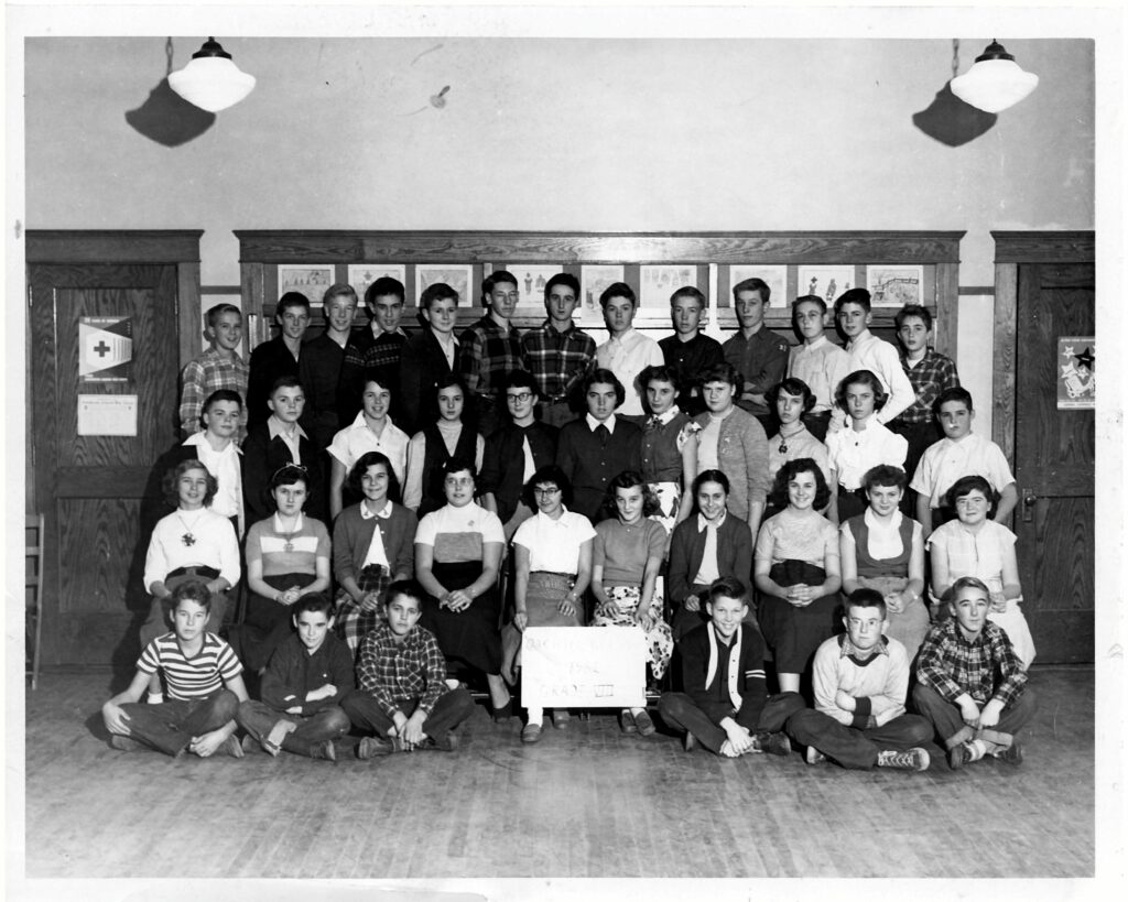
SHS Class of 1954
Programs
Scarborough PTA Presents “The Magician and the Maiden” – 25 May 1957