By Becky Delaware
North Scarborough
Continuing our series about the villages of Scarborough. . .
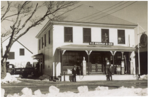
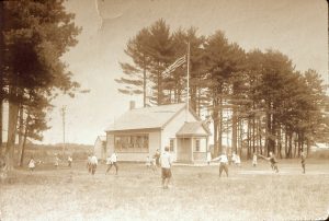
The Village of North Scarborough is often more closely associated with Gorham or Westbrook. For a long time, residents in this area had a Gorham telephone prefix and a Westbrook mailing address. It’s been noted that many residents of this area have felt alienated from Scarborough, as they usually were the last to get any public services and even had to argue intensely to receive them. As true of most villages, North Scarborough had a church, a store (Sherman’s), a school (District #13), a fire station, and a post office (located in Sherman’s store), as well as the Grange. The closest banks were in Gorham and Westbrook!
I am told the stagecoach ran through this village and there was at least one stagecoach stopover. There’s a cemetery, now in South Gorham but originally in North Scarborough, in which many Scarborough people are interred. It’s rumored there might also be an unmarked African American burial ground. Other businesses included a blacksmith, first Charles McLellan, then Bert Libby and finally Arthur Roberts; gas station, the first run by a McKenny (Herb?) on Route 114 and later Leon Vaill on Route 22; The Pines, known for its oyster dinners and dancing afterward, run by the Libby/ Larrabee women; a lumber mill, Herb McKenney; a shingle mill, Carl Temm; and a building-mover, Merry & Sons. Very early there was a soap manufacturer. A “World’s Fair” was held until the late 1940s (as far as I can find). Schools were closed so all could attend the fair. The fair had activities typical of today’s fairs: horse-pulling, livestock competitions, etc.
North Scarborough also was commonly called “Kokill,” Maine-speak for Coal Kiln Corners. There were at least three coal kilns located here. The kilns looked like overgrown beaver houses and were eight- to twelve feet high. The kilns were used to burn alders into pea coal that could be burned in residence stoves. I have read that most of this coal was shipped to Portland for use in apartments.
The boundaries are vague. Roughly, the North Scarborough boundary ran to the Westbrook lines on both Saco Street and Route 22. How far up Route 22 is open to discussion, but probably as far as Crystal Springs Trailer Park. Again, it could be further up or nearer to the corner? The boundary extended down Beech Ridge Road until the border of the Beech Ridge area, again at least to the foot of the steep hill, Lord’s Hill, but maybe a bit further? If you lived there, you knew the boundaries!


